Lustleigh

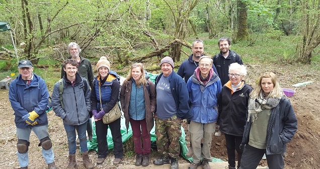
Vinnimore archaeological dig - day 4 team photo
Lustleigh has developed and delivered a wide range of Parishscapes projects from conserving maps to community archaeology initiatives.
The Tithe Map
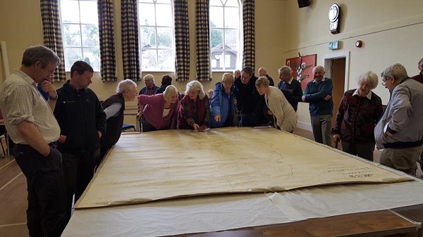
One of Lustleigh’s first projects was the conservation of their parish tithe map. Due to the map’s size, it could only be conserved and displayed in the parish hall and it made for an impressive sight when the Lustleigh Society hosted an open day so that members of the local community and visitors could view the map. A more recent Parishscapes grant will ensure that the Lustleigh Area Map, dating to 1943 is conserved to the same high standard. Another Parishscapes grant has enabled the Lustleigh Society to purchase OS sheets with reference to the 1911 Lloyd George land use maps. This grant along with a grant to renew the Society’s membership of the British Newspapers Online archive, all have a strong research focus and mean that members of the Society and visitors to the archive are able to carry out research into Dartmoor’s recent past. In 2017 an additional grant was awarded for the digitisation of the 'Book of Waye', which is housed in the Lustleigh archive. It comprised of loose-leaf type-written pages and is entirely unique, detailing research from the 1970's.

The tithe map on display in Lustleigh village hall
Pethybridge Woods and Clam Bridges
Parishscapes projects can include natural as well as cultural and built heritage and Patrick Dreyer, one of the Moor than meets the eye Ecoskills volunteers worked alongside Community Ecologist, Chrissy Mason to develop a low intervention management plan for Lustleigh's Pethybridge Woods. The plan’s aim is to increase biodiversity and improve access and conditions for local users of the woodland. A small Parishscapes grant enabled the implementation of elements of the management plan, namely tree surgery works, to be carried out in February 2016 with a further grant being made in 2017 for additional tree works.

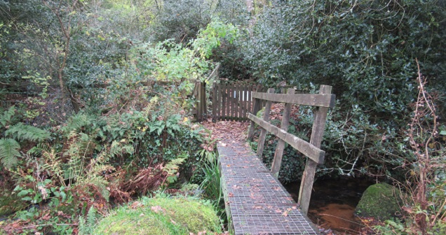
Orchard entrance to Pethybridge Woods
Another small Parishscapes grant was used to carry out an audit of research materials on the history of clam bridges on Dartmoor. As long ago as July 1896, Lustleigh Parish Magazine reported that the tree trunks of the parish’s Clam Bridge were to be replaced because they were in a dilapidated condition. Given that tree trunks probably have a life of more than 25 years there is every reason to believe that there has been a Clam Bridge in place in Lustleigh for over 150 years, and possibly much longer. This is supported by the fact that a footbridge at that site is marked on the 1864 Ordnance Survey map. The construction of the Clam Bridge is similar to the stone clapper bridges which are common on Dartmoor. However, as Crossing noted in his 1912 ‘Guide to Dartmoor’, clam bridges are ‘seldom seen on Dartmoor’. The Clam Bridge in the Bovey Valley is believed to be the last Clam Bridge made from tree trunks on a public path on Dartmoor. The first stage of this project was to look at the material that exists - photographs and postcards, published and unpublished written material and maps. The audit revealed there is enough material for a small booklet but not for an exhibition as originally hoped.
Vinnimore Community Excavation
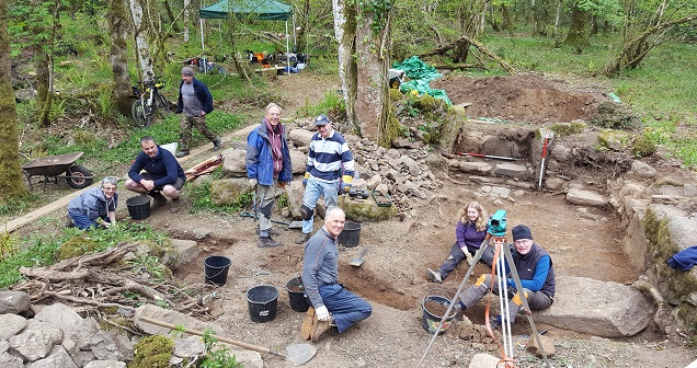
Lustleigh’s Parishscapes-funded community archaeology project took place in the Bovey Valley in late March aiming to shed more light on the post-medieval farmstead of Vinnimore, a site which first appears on historic maps in 1765. The excavation, carried out between 24th and 29th March was a collaboration between the Lustleigh Society, Natural England volunteer group The History Hunters, East Dartmoor National Nature Reserve, The Woodland Trust and Dartmoor National Park Authority.

Community volunteers on the final day of the archaeological dig at Vinnimore
Community Heritage Officer Emma Stockley, who leads Parishscapes explains “the Vinnimore dig was a great example of a community heritage project which brought a number of different groups and organisations together to help tell the Dartmoor story. It was a hugely rewarding and enjoyable week and hats off to all our fantastic volunteers who were involved”.
The excavation focused on the ruinous farmstead located within idyllic woodland close to Hisley Bridge. Volunteers from Lustleigh and further afield worked alongside professional archaeologists from Oakford Archaeology to uncover the remains of the main dwelling and a number of open-fronted rooms, thought to be used for storage or to house animals. Two hearths were excavated, one with the remains of a bread oven within its walls, and part of the farmhouse’s original floor was uncovered. The hearths, along with the presence of window glass, suggest that the building was of a higher status than initially thought. Other finds included pottery and pieces of clay pipe dating to between 1750 – 1850. Built sometime in the eighteenth century and abandoned by the nineteenth, the farmstead appears to have had a period of occupation of less than 100 years. Whilst evidence of an earlier building was absent, the discovery of a number of flint tools, including a Mesolithic microlith, indicates much earlier human activity at the site.
An East Dartmoor Woods blog was kept up to date throughout the week and this can be read here https://eastdartmoorwoods.org/2017/04/25/news-from-the-vinnimore-dig-day-1/
Next Steps
For more information, please contact the Community Heritage Officer and Parishscapes project lead Emma Stockley emma@moorthanmeetstheeye.org
01822 890 904
07749 855 373
For more information on The Lustleigh Society and archive visit their website here
Last update: 24 May 2017 4:37pm

